Descending into our study area in the Richardson backcountry, almost exactly halfway between Fort McMurray and Fort Chipewyan in north-eastern Alberta, stirs up a mix of emotions. Our study area lies within Canada’s magnificent boreal forest —a fire dominated landscape comprising burned and unburned patches of upland jack pine (Pinus banksiana) and black spruce (Picea mariana) bog. The benefit (or is it challenge?) of a remote study location in the boreal forest is that travel is by helicopter and visits are timed to coincide with frozen ground. This also means that we are treated to incredulous, frosty views along the way. Lifting off from a heli pad in Fort McMurray we immediately see the devastation of the 2016 Horse River wildfire (aka ‘the beast) on the city and surrounding forest. The wildfire scarred landscape is quickly superseded by the seemingly endless, stitched together checkerboards of 3-D seismic lines (linear features created for oil and gas exploration), which changes to the expansive ex-situ mines analogous to “oil sands” in most minds, and finally on to stunning ecological features such as the McClelland Lake fen complex and the Marguerite River, predominantly ensconced within a Wildland Provincial Park bearing its name. It is a stir of emotions because the tendrils of human disturbance are weaving their way into even this remote landscape; outside the park, legacy and newly cut seismic lines criss-cross the forest. And yet, while these linear features transfix your gaze, the omnipresent disturbance is wildfire. In 2011 a massive wildfire swept through the Richardson backcountry —the second largest documented fire in the history of western Canada1. From May to August the Richardson fire burned ~576 000 ha of forest with mixed-severity, leaving some residual unburned patches while other patches burned so severely that all overstory trees died1. To put this into perspective, the entire perimeter of the Richardson wildfire encompassed 658 000 ha, compared to ~590 000 ha for the 2016 Horse River fire. With the changing climate, wildfires in the boreal are expected to occur more frequently and burn larger areas2, making fires like the Richardson and Horse River the norm rather than the exception.
 |
 |
 |
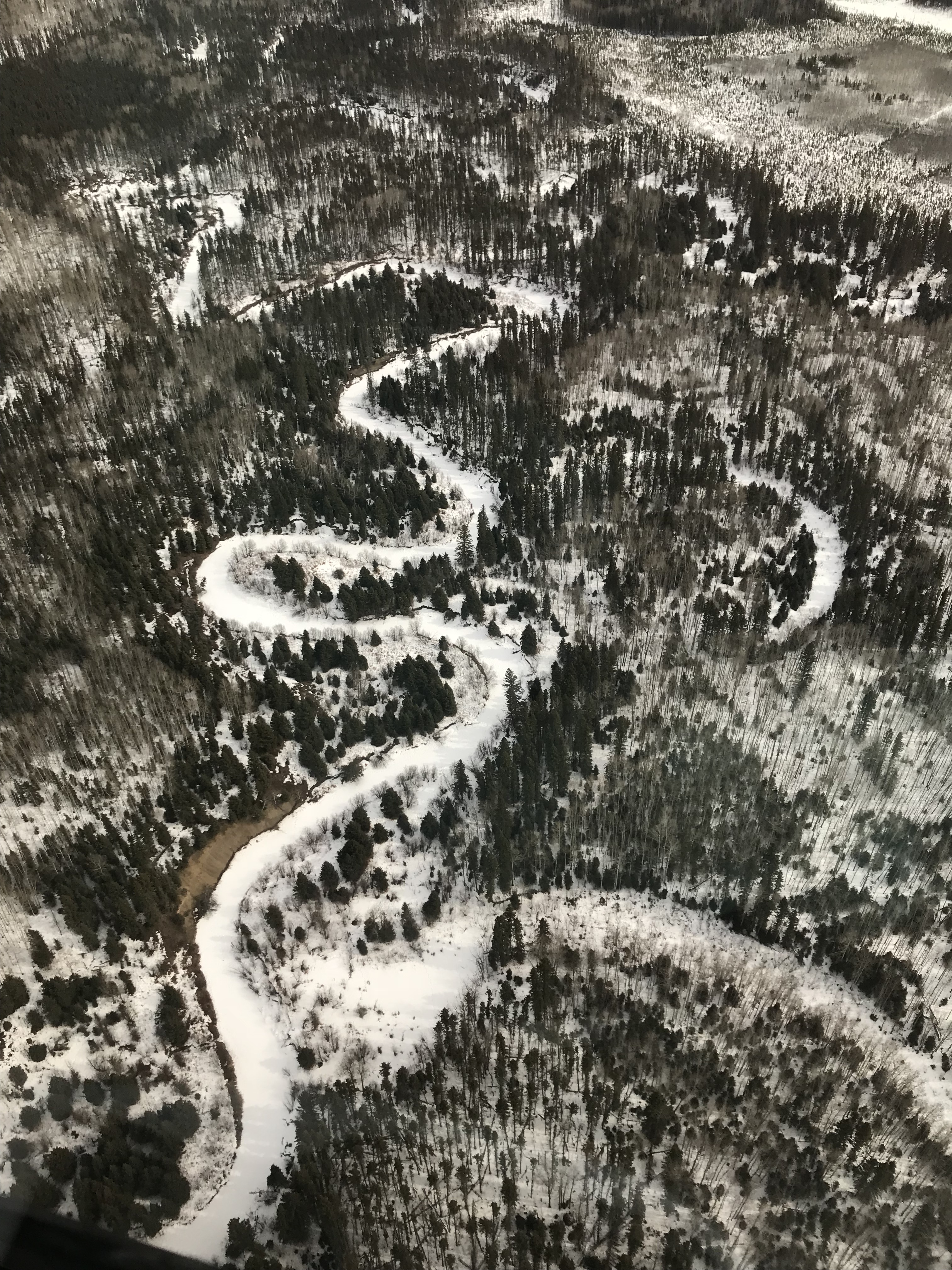 |
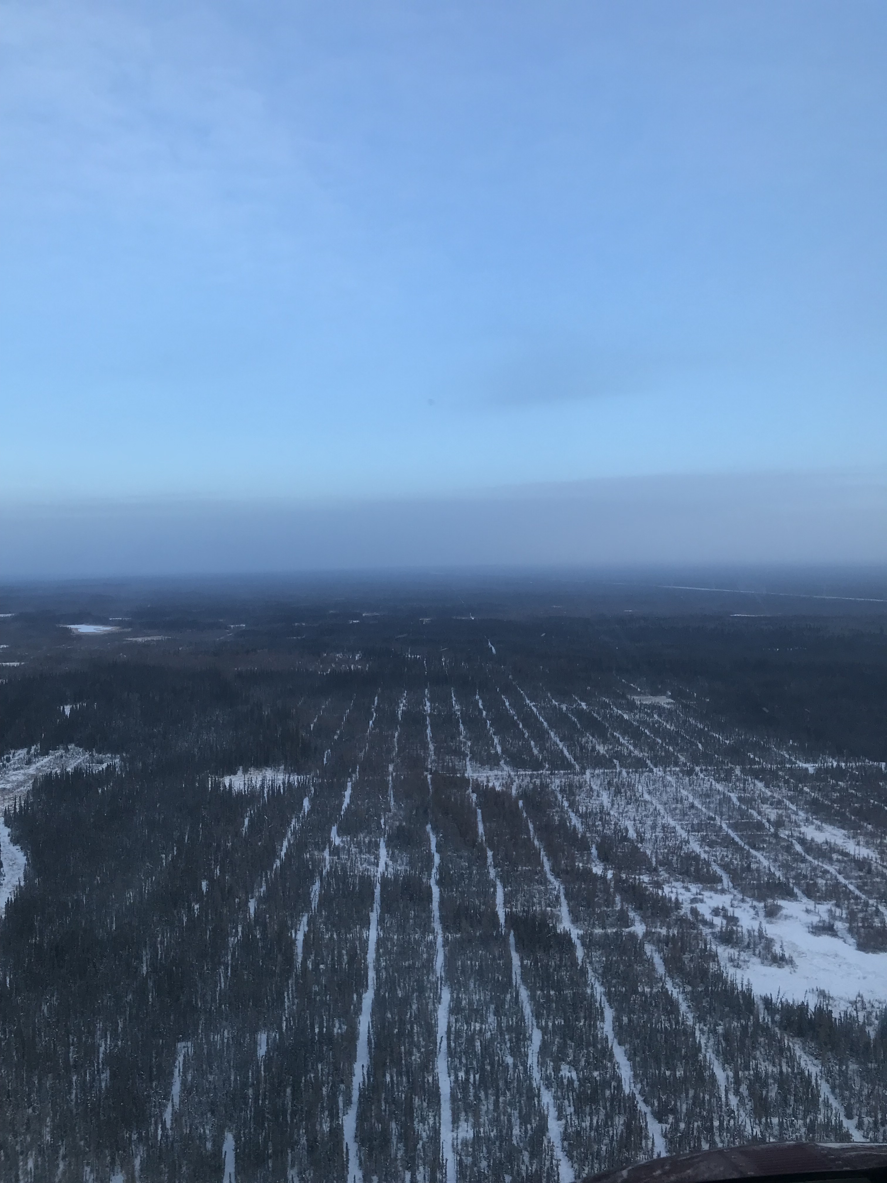
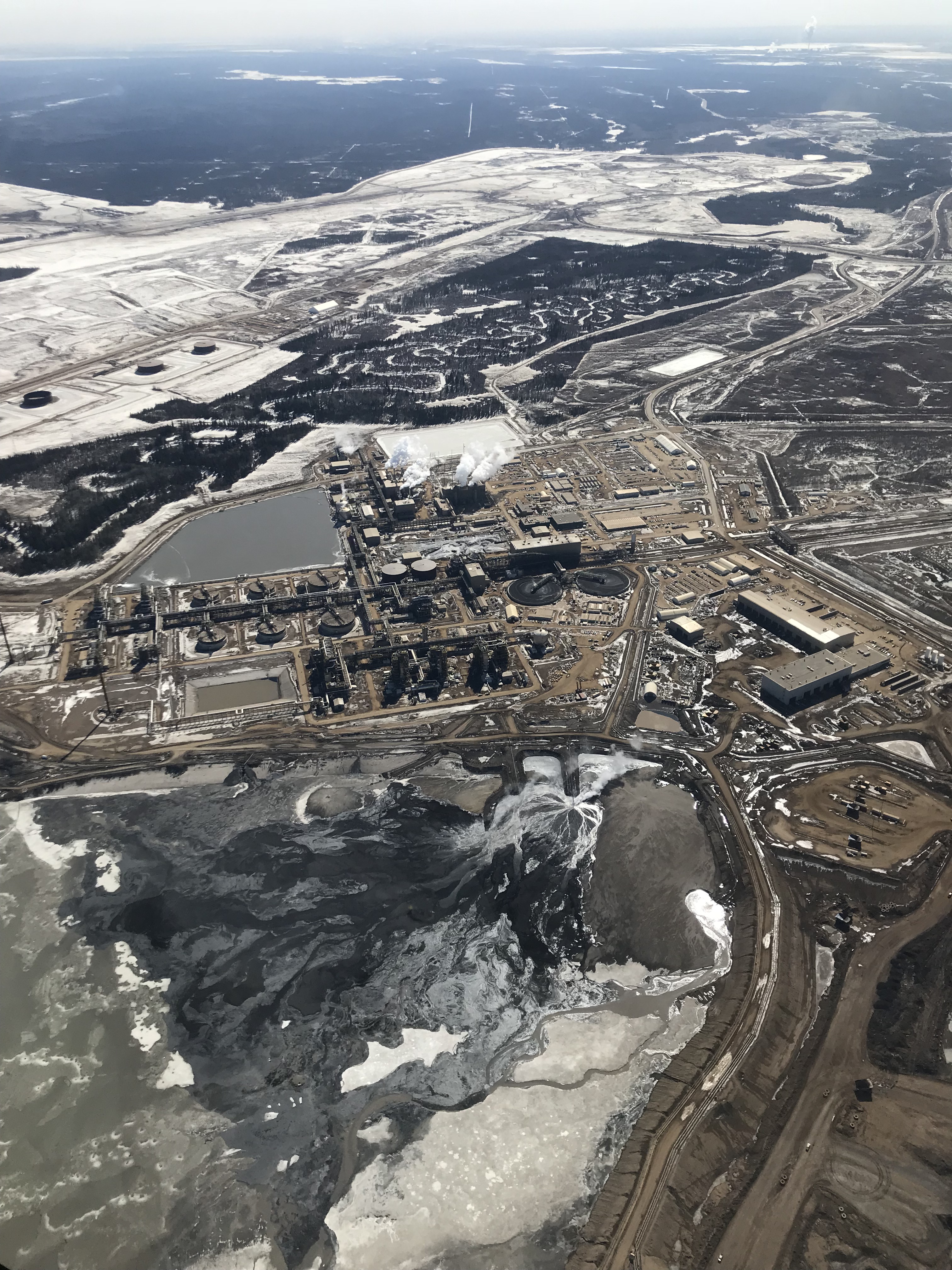
Fig 1. The view travelling north from Fort McMurray to the Richardson; from left to right: 3-D seismic lines, ex-situ oil sand mines, McClelland Lake fen complex, and Marguerite River Wildland Provincial Park.
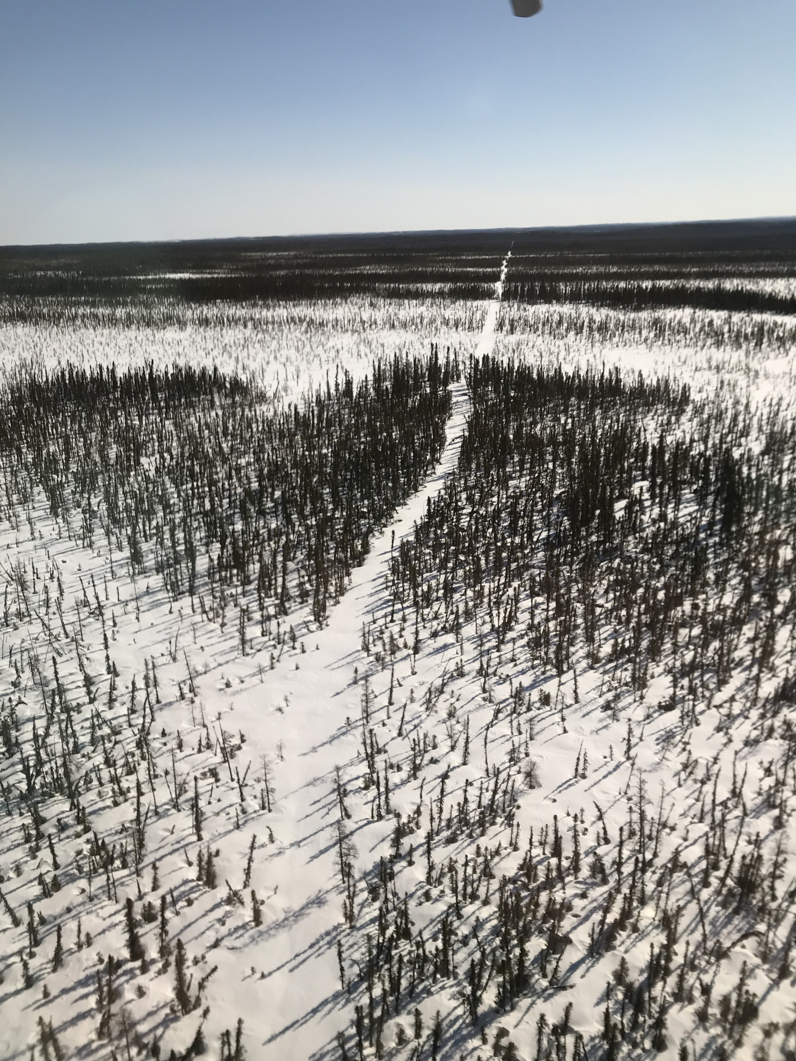
To better equip ourselves with an understanding of how wildlife reacts to wildfires we are conducting a multi-year camera trap study within the Richardson backcountry. One of the goals of our study is to determine if camera traps can be an effective means of monitoring remote ungulate populations. The other is to study the effects of wildfire and oil sands mining on boreal mammal communities in a system with relatively little human disturbance —the irony of our carbon hungry mode of field travel is not lost on us. In this corner of Alberta ungulate refers to moose (Alces alces) and woodland caribou (Rangifer tarandus caribou). The white-tailed deer (Odocoileus virginianus) invasion has yet to reach this far north. Infrequent government surveys make it difficult to know how populations are tracking over time but it is believed that both moose and caribou populations are stable. A recent government survey estimated 7.0 moose/100 km2, although infrequent surveys make it difficult to know if this is stable3. The draft provincial woodland caribou range plan elevated the status of the Richardson caribou herd to ‘stable’4 from the 2011 federal government distinction of ‘not self-sustaining’5. It is unlikely that the population has improved in the last decade but rather the push for research has provided sufficient data for a more accurate assessment. Caribou minimum count surveys equate to a minimum density of 1.8-2.1 caribou/100 km2 across the 707 350 ha of Boreal Shield and Boreal Plains that comprise the Richardson caribou range.
 |
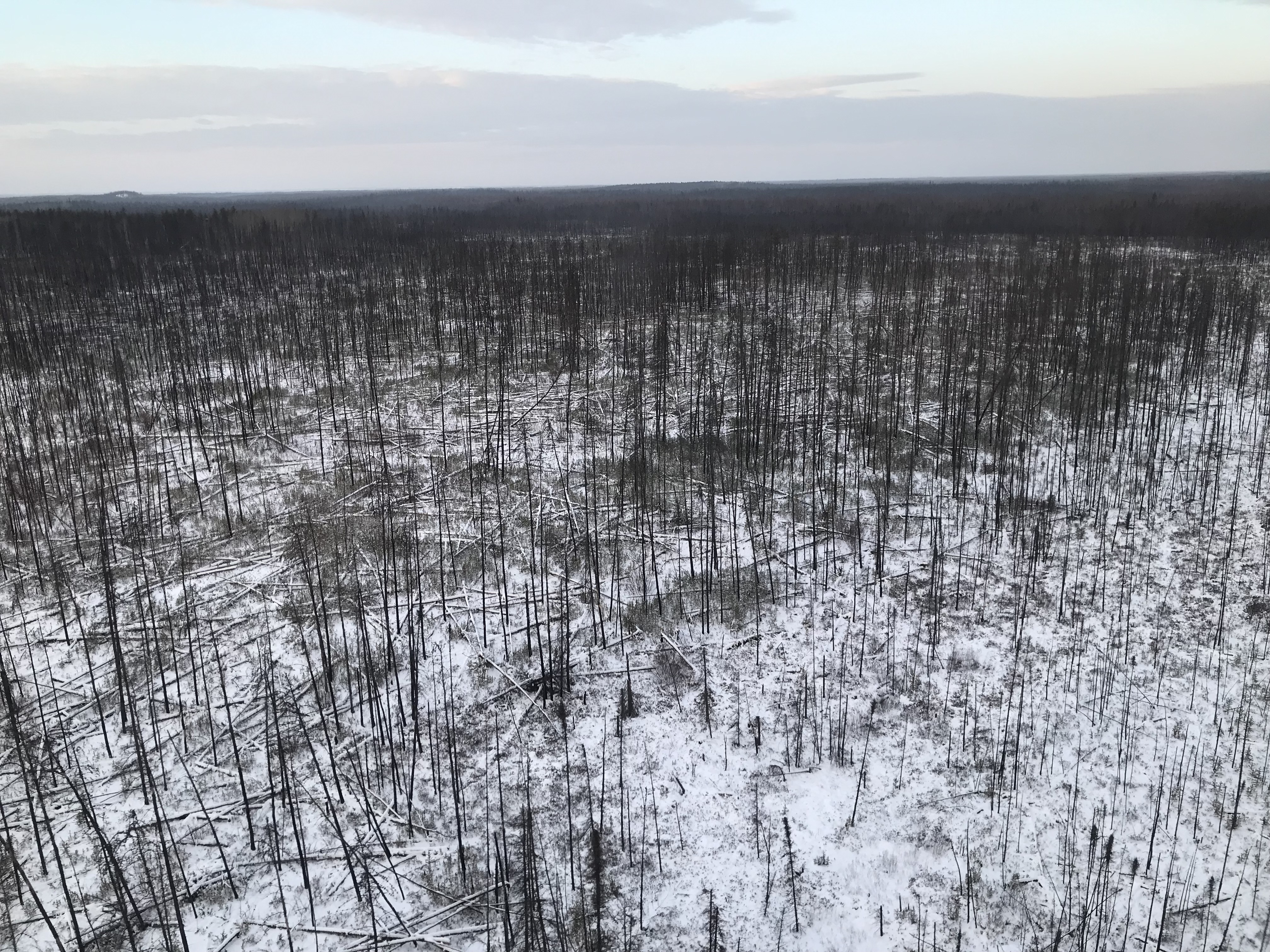 |
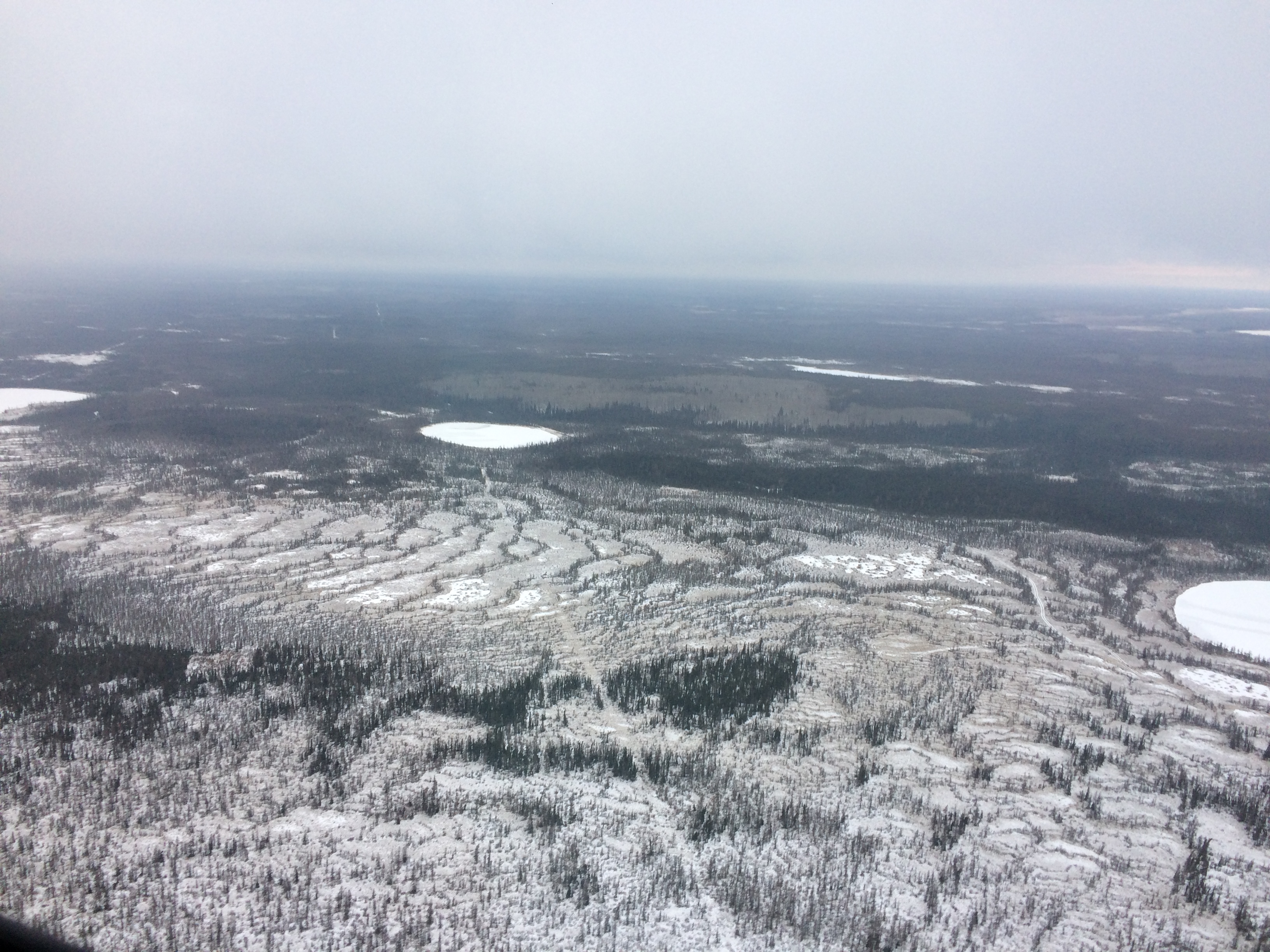
Fig 2. The Richardson caribou range comprises 84% disturbed habitat, in the form of seismic lines (left) and wildfire burns (right).
So why do Richardson caribou have the fortunate ‘stable’ status, however precarious, when half of the woodland caribou herds in Canada are declining? In Alberta, the well-versed answer is human disturbance —predominantly through oil exploration, timber harvesting and road infrastructure— which has cumulatively and rapidly increased disturbance rates in Alberta’s boreal forests6. The network of linear features on the landscape allows predators, such as wolves (Canis lupus), better access, as well as the means for faster travel, into the heart of caribou habitat7. Disturbance also provides foraging opportunity for moose (Alces alces) and white-tailed deer (Odocoileus virginianus), providing abundant sources of alternate prey to caribou predators8. To mitigate against habitat loss, the federal government recovery strategy for woodland caribou requires that critical habitat contain a minimum of 65% undisturbed habitat5. Not one caribou range in Alberta meets this threshold; at best the Caribou Mountain range contains 35% undisturbed habitat , while the Richardson range ties for 3rd with 16% undisturbed habitat4. Disturbance can be either anthropogenic —human disturbance as seen from satellites at a scale of 1:50 000, including habitat within a 500 m buffer— or natural —a wildfire burn less than 40 years old5. It is clear that Richardson wildlife have more natural, than human, disturbance to contend with. Indeed, 65% of disturbance within the Richardson caribou range comes from wildfire while 36% is attributed to humans, most of which stems from seismic lines4. And so our burning research question asks if a burn erases a seismic line —does wildfire placate the effect of seismic lines on caribou, and the boreal mammal community, or instead might there be an additive or synergistic effect?
 |
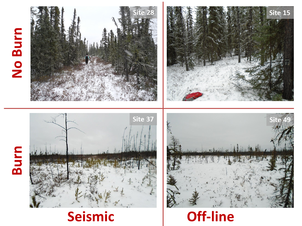 |
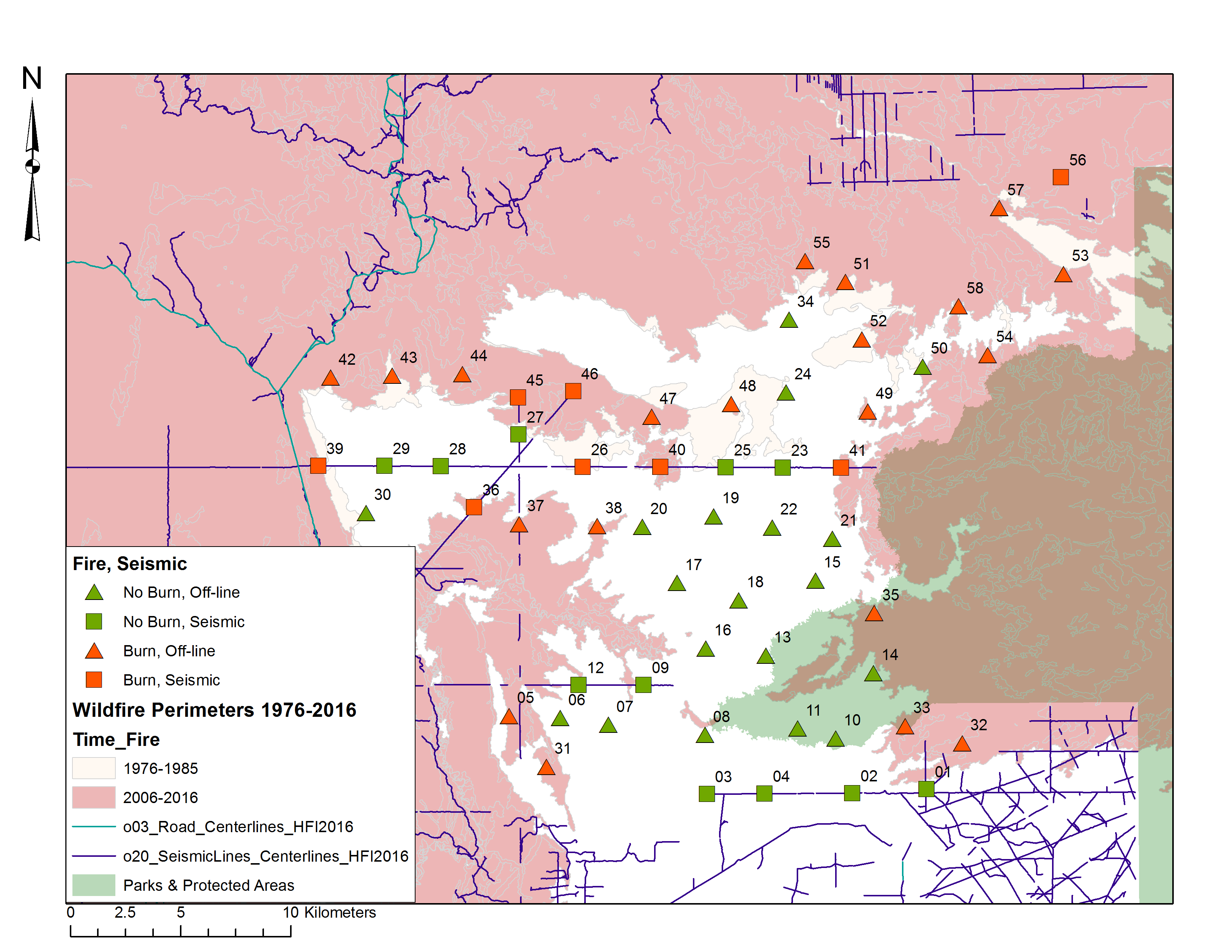
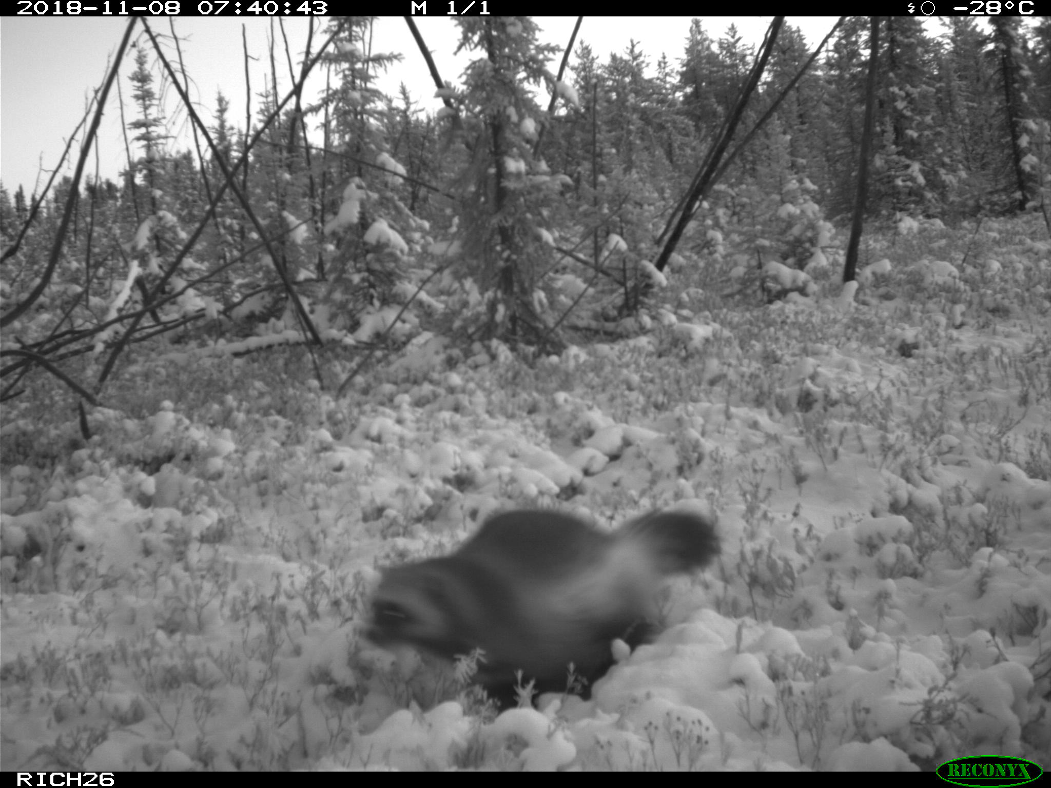
Fig 3. We have deployed 58 cameras in the Richardson backcountry: 11 outside burn, on seismic; 8 within burn, on seismic; 19 outside burn, off-line; 20 inside burn, off-line.
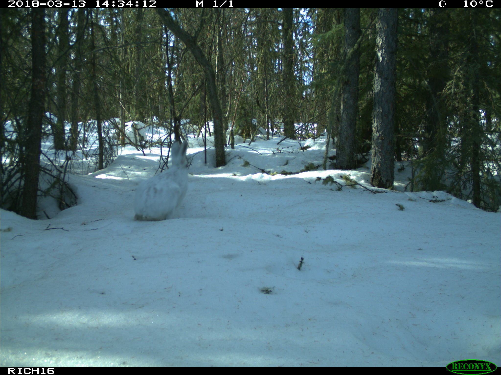
To answer our research questions we have deployed 58 cameras on and off seismic lines, in and out of wildfire burns. The first 30 cameras were deployed in November 2017, outside wildfire burns but on and off seismic lines. The remaining 28 cameras were deployed in 2018, inside wildfire burns, both on and off seismic lines. We have just retrieved our first year of data and are already learning more about this remote landscape. Our cameras have captured elusive species, predatory-prey interactions, recruitment and health of individuals. We have detected 14 mammal species, including an abundance of snowshoe hares, one lone detection of a white-tailed deer on the western boundary of our study area and within close proximity to the winter road, and three wolverine detections, spread across the study area. Caribou seem to segregate themselves, hugging the northern end of the study area, while moose and predators tended to congregate in the south-eastern portion of the study area. Preliminary analyses suggest that some species may be avoiding seismic lines, although it’s too early to say for certain.
 |
 |
 |
 |
 |
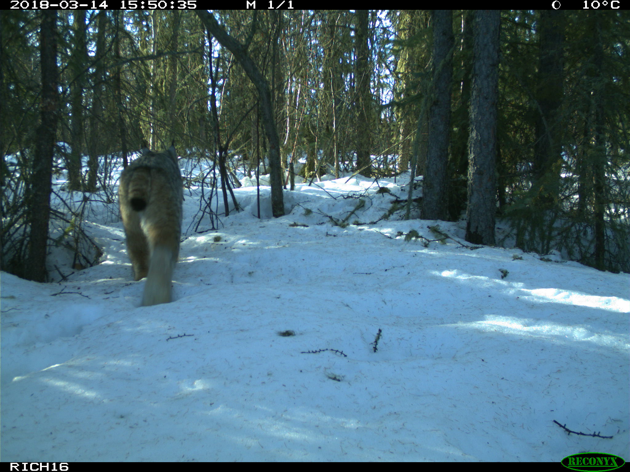 |
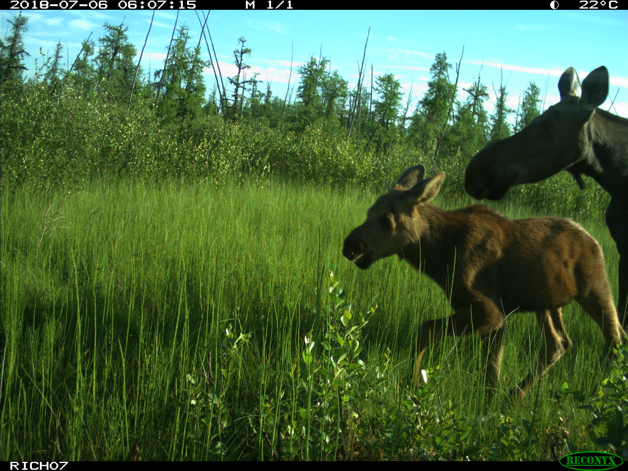
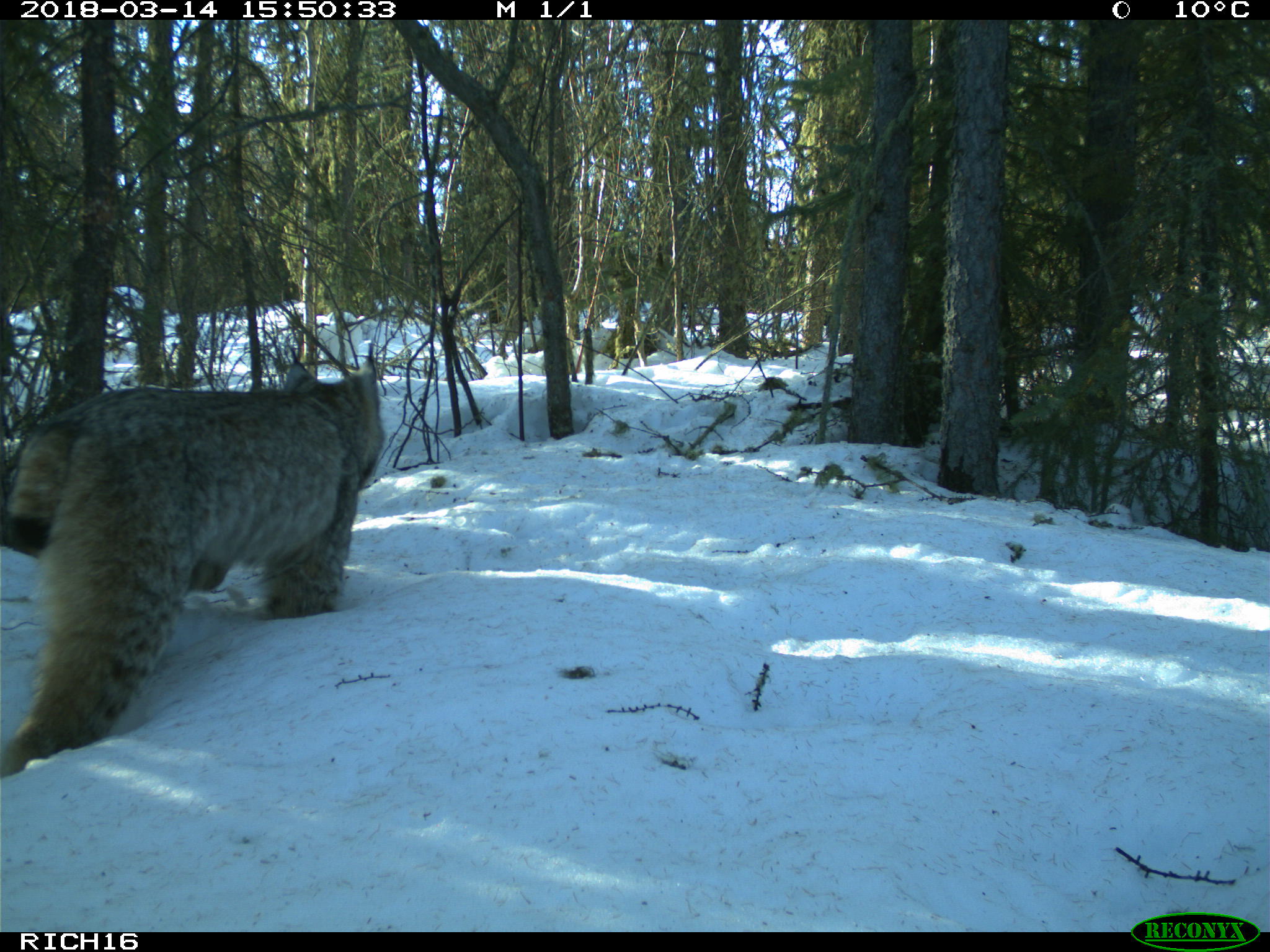
Fig 4. Camera traps capture elusive species (wolverine, top left), predator-prey interactions (fox and snowshoe hare, top center; snowshoe hare and lynx, bottom sequence; and recruitment (moose cow and calf, top right).
Will these patterns hold true for sites within the wildfire? We hypothesize that in upland areas wildfire may well erase the influence of human disturbance, or at least alter it. Research shows that within a burn jack pine regeneration on a seismic line is two-fold higher, compared to adjacent off-line areas9. In a fire dominated landscape in Saskatchewan caribou avoidance of human features is inconsistent and scale dependent10. In the Richardson, early findings from a University of Alberta MSc project suggest that female caribou generally avoid burns: avoiding burned landscapes entirely at the home range scale and burned patches at the local scale (Sean Konkolics, pers comm). How will the rest of the boreal mammal community react to burns? We eagerly wait for next November when frozen ground conditions permit us to once again visit our study area and review which species have made an appearance on our cameras.
In the Richardson backcountry, wildlife live in a world of ice and fire, although in this Westeros the long night is unlikely to be coming anytime soon.
 |
 |
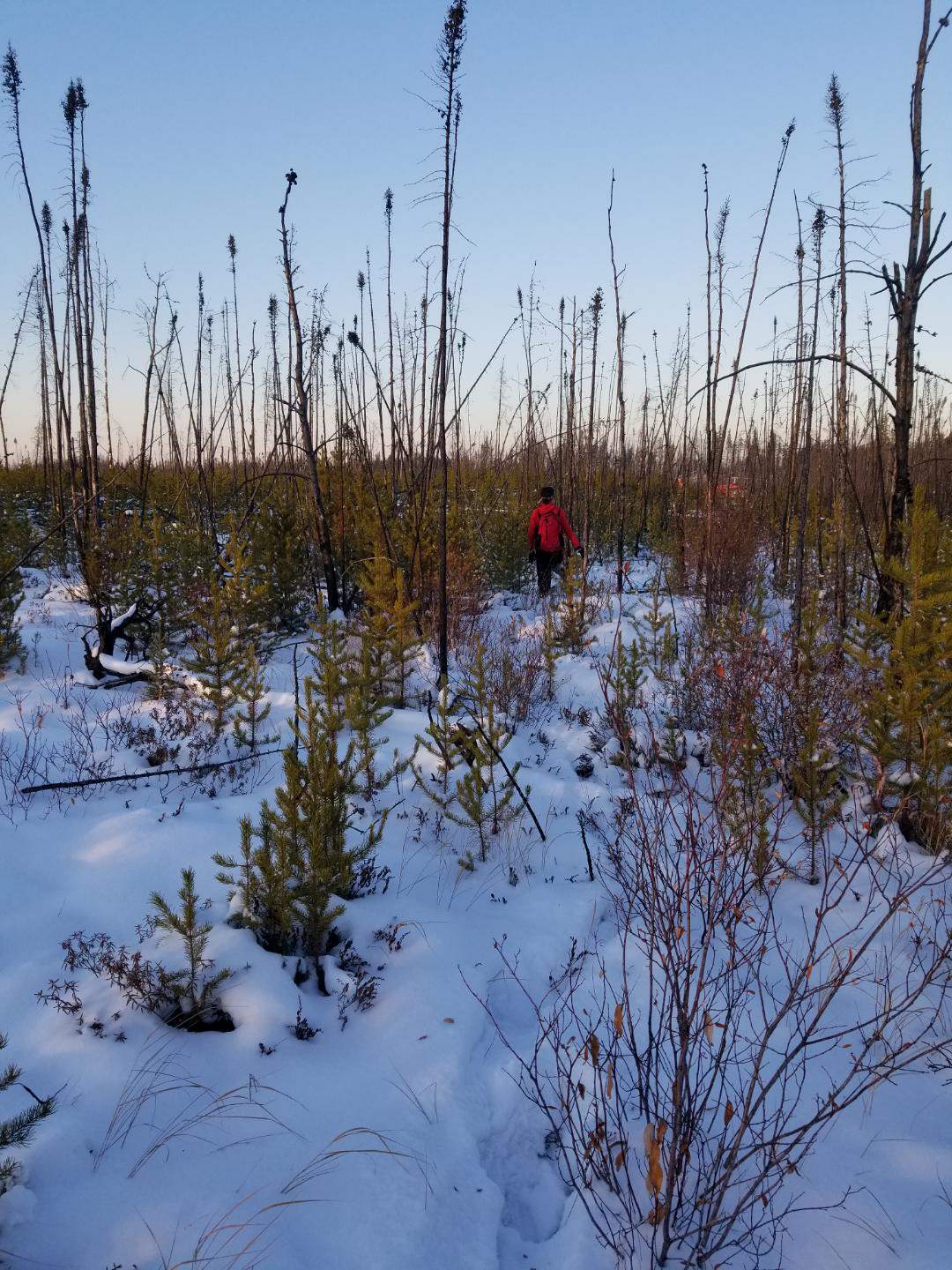 |
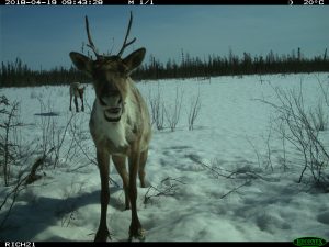
Fig 5. Caribou tracks crossing a black spruce bog, a collared caribou cow and calf, and me traversing a wildfire burn en route to a camera trap (photo credit, Erin Tattersall).
References:
- Pinno BD, Errington RC, Thompson DK. Young jack pine and high severity fire combine to create potentially expansive areas of understocked forest. For Ecol Manage. 2013 Dec;310:517–22.
- Wang X, Parisien M-A, Taylor SW, Candau J-N, Stralberg D, Marshall GA, et al. Projected changes in daily fire spread across Canada over the next century. Environ Res Lett. 2017 Feb 1;12(2):025005.
- Alberta Environment & Parks. Wildlife Management Unit 530 moose aerial survey (2018). Edmonton, Alberta, Canada; 2018.
- Alberta Government. DRAFT Provincial Woodland Caribou Range Plan. Edmonton, Alberta, Canada; 2017.
- Environment Canada. Recovery Strategy for the Woodland Caribou (Rangifer tarandus caribou), Boreal population, in Canada. Species at Risk Act Recovery Strategy Series. Ottawa, Canada; 2012.
- Hansen MCC, Potapov P V, Moore R, Hancher M, Turubanova SA a, Tyukavina A, et al. High-Resolution Global Maps of 21st-Century Forest Cover Change. Science (80). 2013 Nov 15;342(6160):850–3.
- Dickie M, Serrouya R, McNay RS, Boutin S. Faster and farther: wolf movement on linear features and implications for hunting behaviour. du Toit J, editor. J Appl Ecol. 2017 Feb;54(1):253–63.
- Latham ADM, Latham MC, Knopff KH, Hebblewhite M, Boutin S. Wolves, white-tailed deer, and beaver: implications of seasonal prey switching for woodland caribou declines. Ecography. 2013;36(12):1276–90.
- Filicetti AT, Nielsen SE. Fire and forest recovery on seismic lines in sandy upland jack pine (Pinus banksiana) forests. For Ecol Manage. 2018 Aug;421(December 2017):32–9.
- Mcloughlin PD, Stewart K, Superbie C, Perry T, Tomchuk P, Greuel R, et al. Population dynamics and critical habitat of woodland caribou in the Saskatchewan Boreal Shield Status of Woodland Caribou in the Saskatchewan Boreal Shield. Interim Proj Rep. 2016;162.